East Maui Watershed

Donate
  • About Us
    • History
    • Partners
    • Staff
  • Explore the Watershed
    • How does it work?
    • Threats
    • Management
    • Hawaiian Culture
    • Bird Gallery
  • Public Education
    • Community Programs
    • Educational Resources
  • Get Involved
    • Careers in Conservation
    • Take Action
    • Donate
  • Contact
  • MWA Art Show

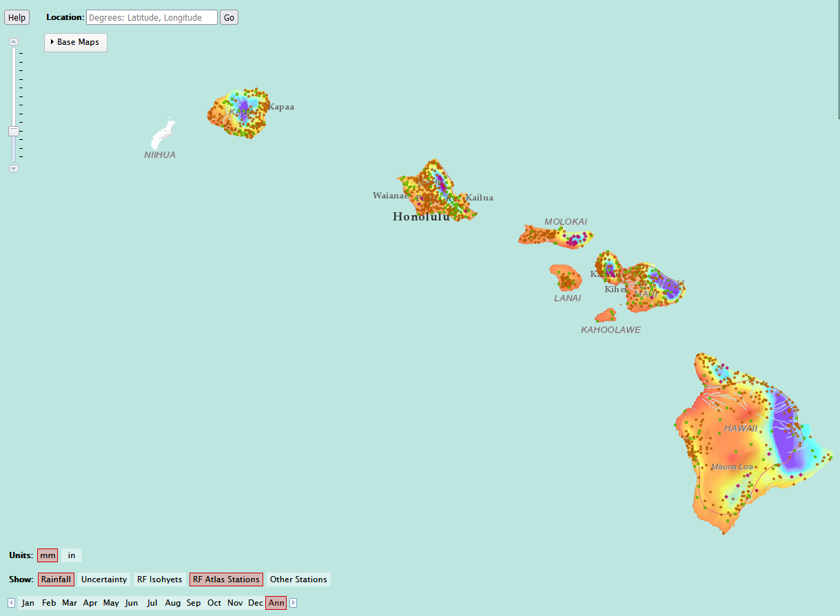
Interactive and Downloadable Maps

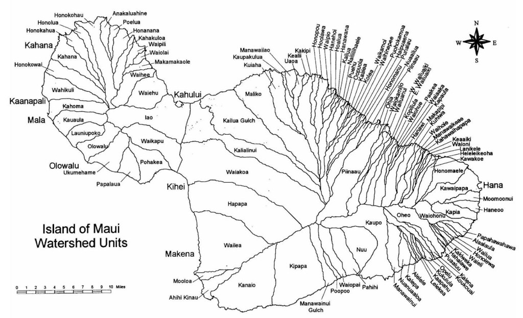
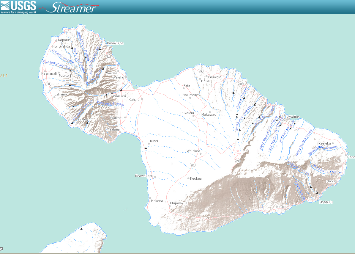
Ahupua’a & Watershed Units of Maui


Ahupua’a are a part of a land division system created by Hawaiians that runs from mauka (mountain) to makai (sea). In ancient times they served as boundaries for native communities that included all the resources needed for survival.

Watersheds are an area of land where surface and ground water flow from higher elevations downhill to a larger body of water like a lake, stream or ocean. Nature defines these units and protecting them ensures a good supply of water for us to use.

Ahupua’a and watersheds are very similar, often sharing boundaries. Use this map below to find YOUR ahupua’a and watersheds unit! Works best on a laptop or desktop computer.
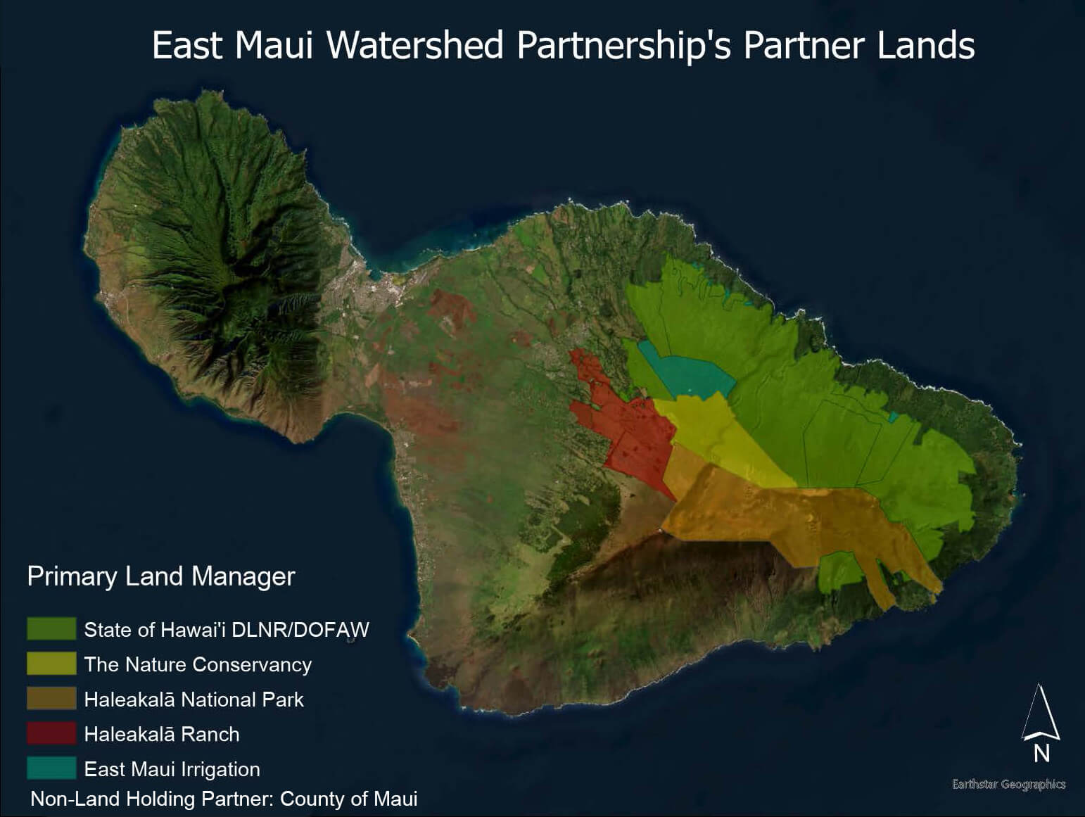
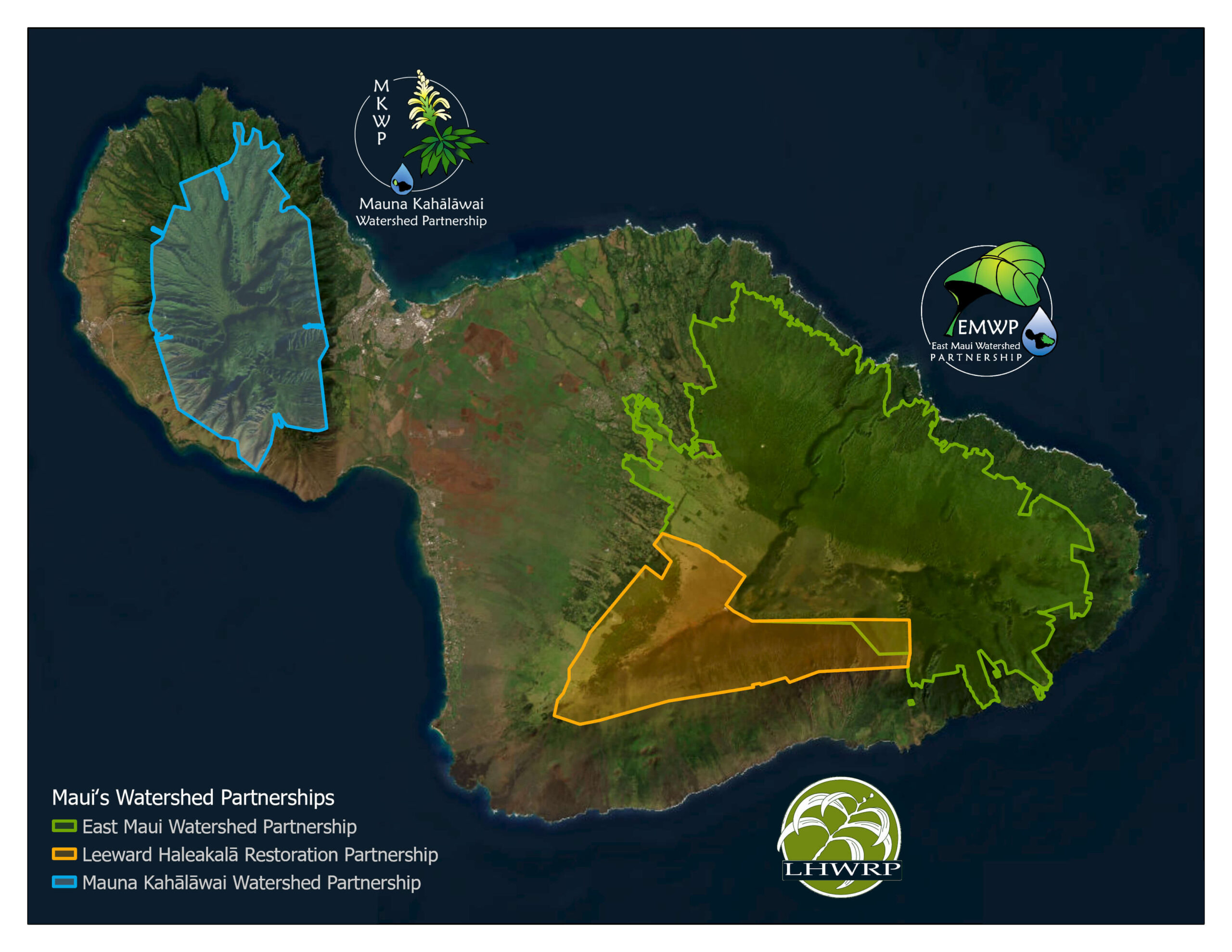
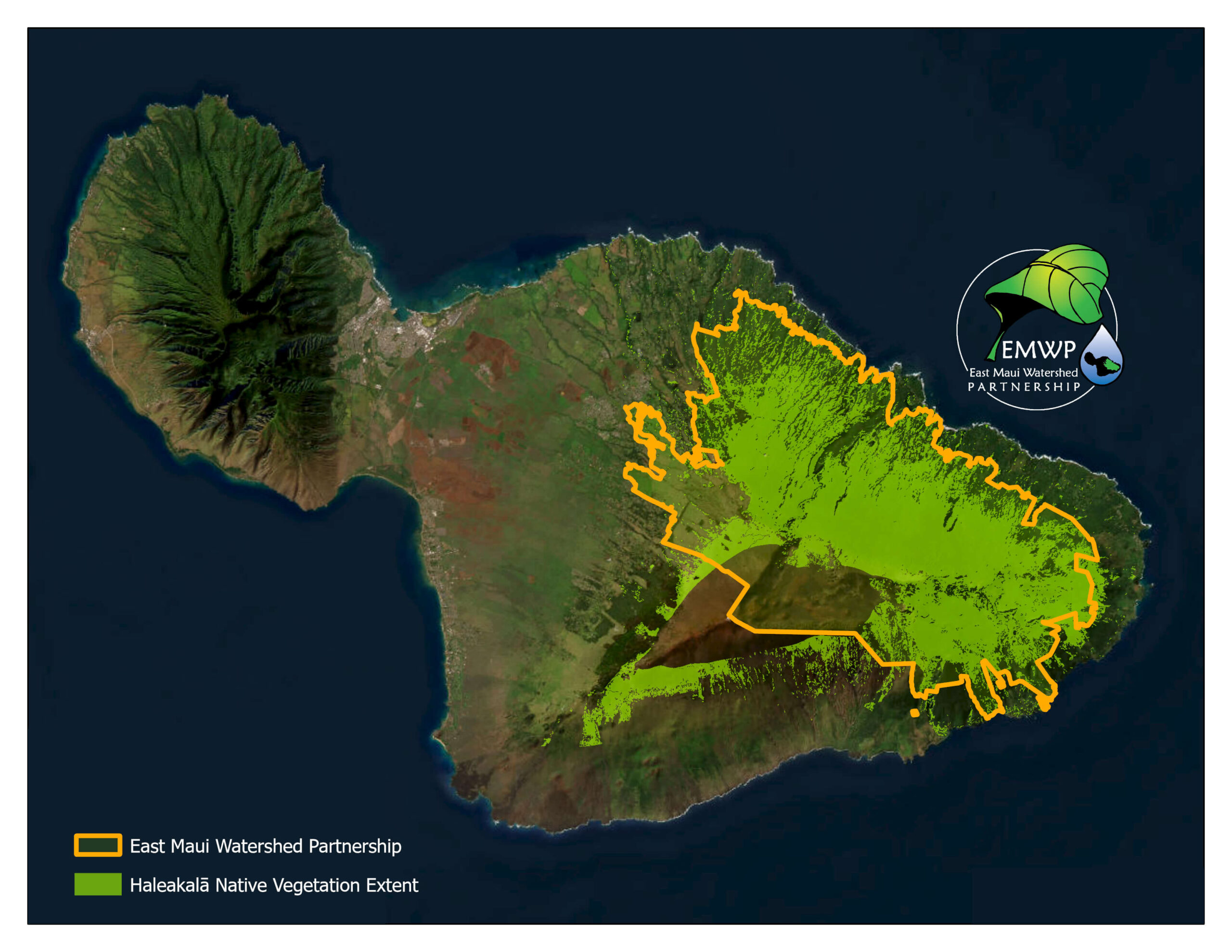
Downloadable Maps

East Maui Watershed Partnership Lands
Major Land Holdings of the East Maui Watershed Partnership
Download
Maui Watershed Partnrships
Watershed Partnerships across Maui
Download
Maui Watershed Units
Maui Island Watershed Units
Download
Extant of East Maui Native Vegitation
Extent of Native Vegetation on East Maui
Download

Interactive Maps

Streamer Map
Interactive USGS Map of the nations streams
Explore
Map
Hawai’i Climate Data Portal
Explore

(Return to Educational Resources)

DLNR Official Logo
Haleakala Ranch logo
UH Manoa logo
PCSU logo
County of Maui logo

EAST MAUI IRRIGATION

NPS logo

Haleakalā National Park

Contact Us

P.O. Box 431
Makawao, HI 96768

(808)573-6999
info@eastmauiwatershed.org

Stay Connected

Return to Top

Email Updates

Name

Copyright © 2025 • Log in• Sitemap • Designed by Websites with Aloha